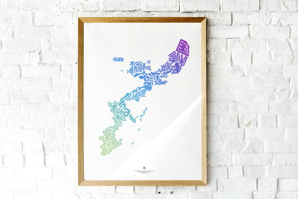
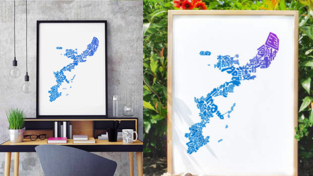
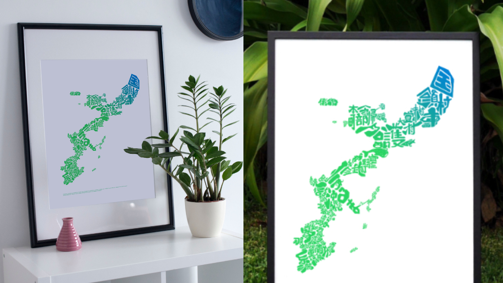

Since its initial launch in 2016, the Okinawa Map has become the talk of the town in Okinawa. You see it in your friend’s home, on social media, at the community center, in local cafes, and restaurants. Teachers in Okinawa are now using this map to educate young Okinawans about the beautiful island they call home.
Here’s a quick rundown: The map is assembled using the names of Okinawan cities in Japanese. Each name follows the shape of its respective city.
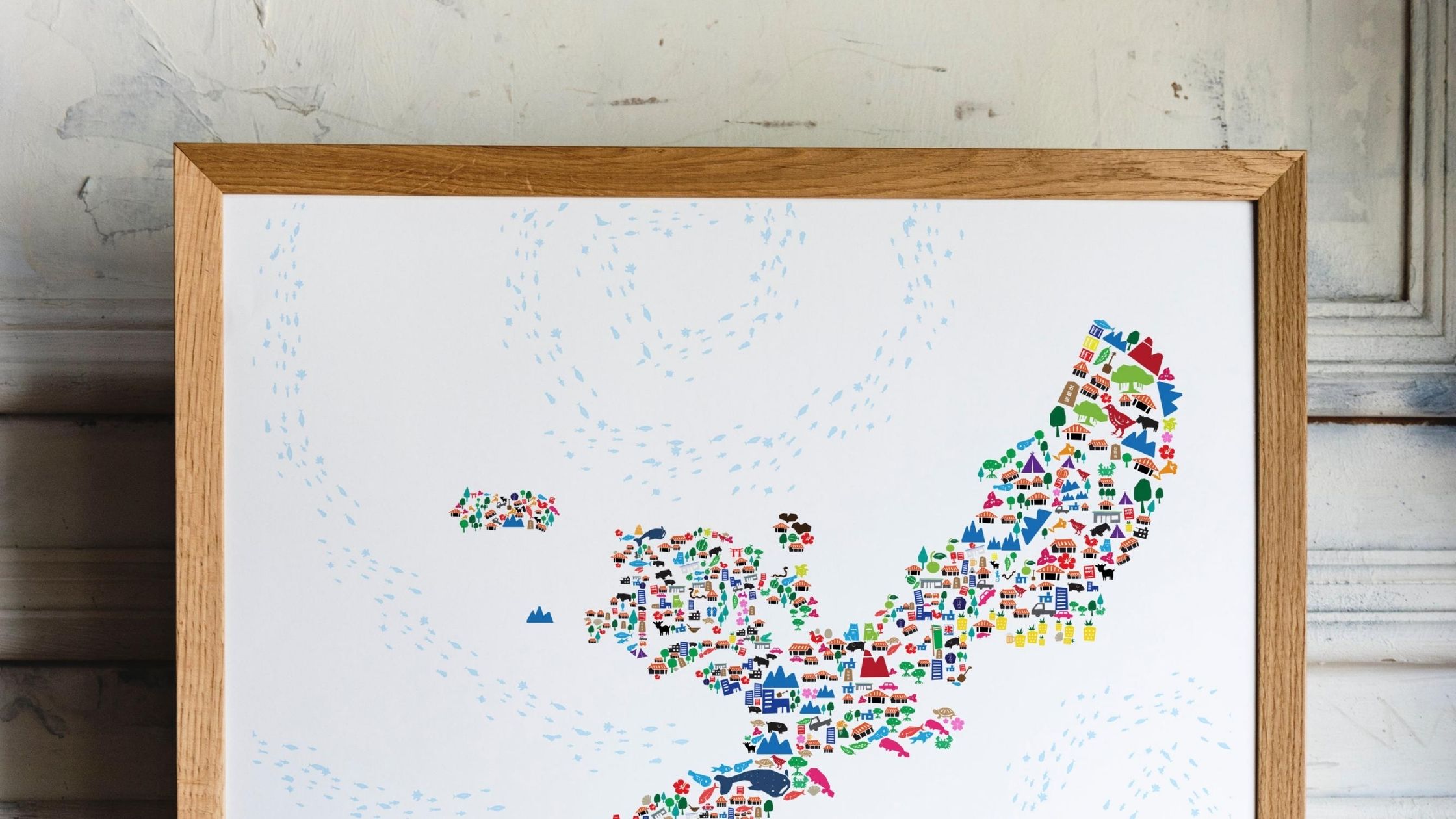
The latest version of the map features over 30 hidden symbols representing celebrated tourist spots, local products, folktales, and the history of the Ryukyu Kingdom.
Discover the hidden symbols in the map and the stories behind them. Each short article below highlights a hidden symbol. Let’s explore the hidden side of Okinawa.
-
2020 Summer Special Okinawa Story Map Is Now Available
Stories and inspiration behind the 2020 summer special edition Okinawa Story Map. The theme of the 2020 edition is This Time. This…
-
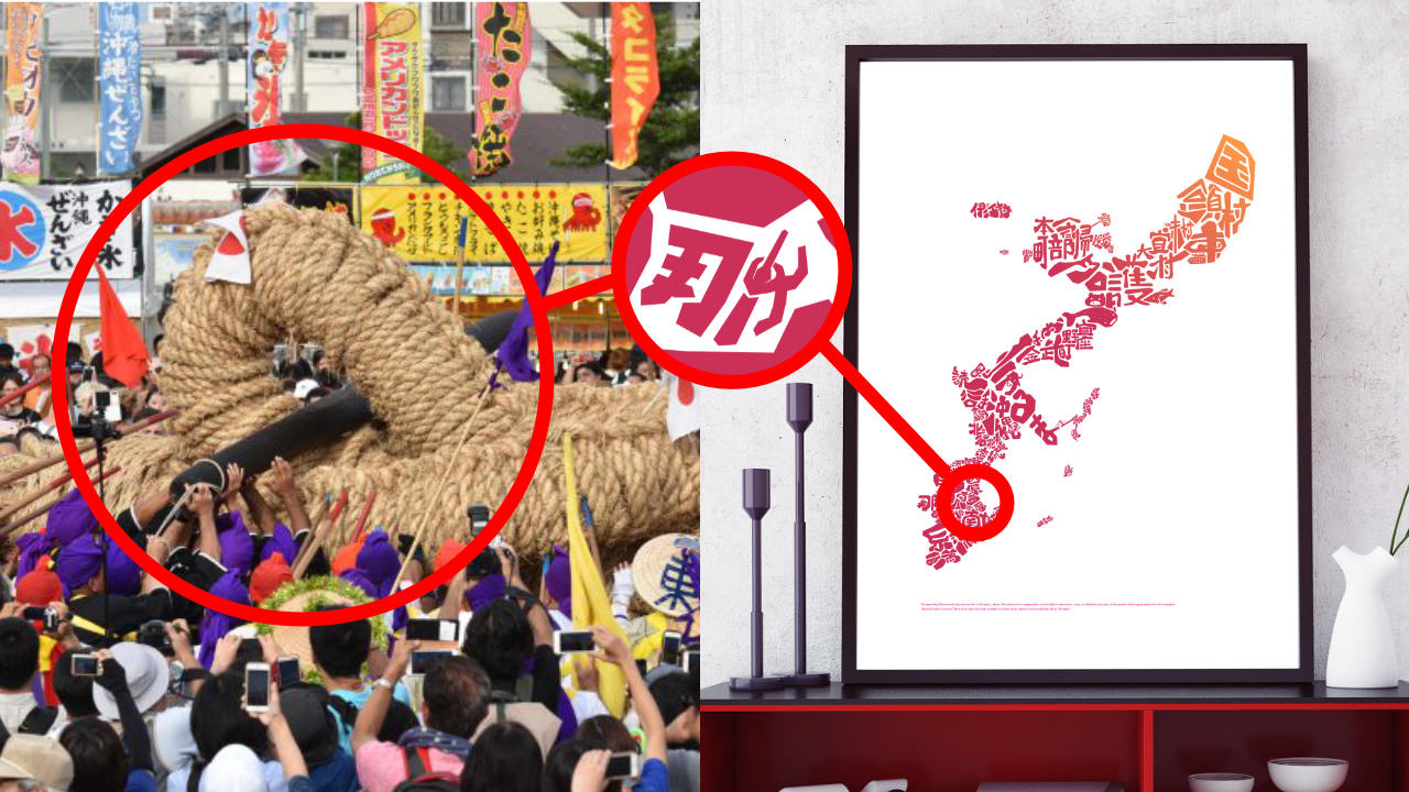
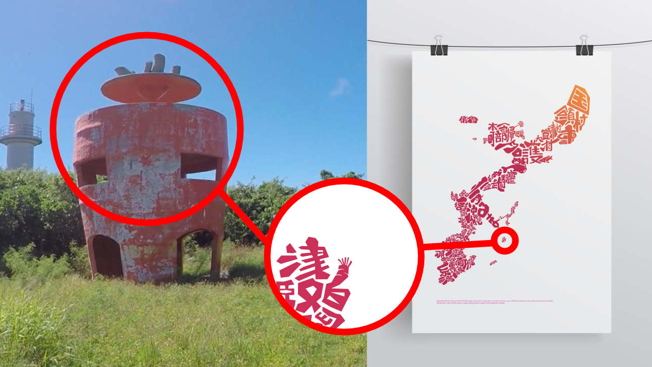
Secret In The Map #11: Tug of War in Yonabaru
There is a big thing in a small town in Okinawa, so big that it led to Guinness World Record. Learn about Ootsunahiki, a proud Okinawa tradition hidden in your Okinawa Story Map…
-
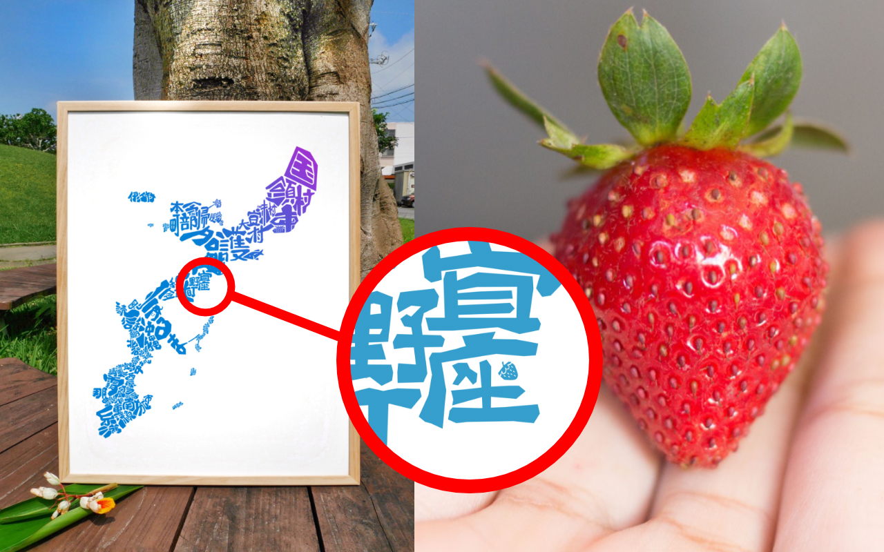
Secret In The Okinawa Map #10: Strawberry In Ginoza
Discover another secret hidden in your Okinawa Story Map about a small town that contributes to Japan’s reputation of being one of the …
-

Secret In The Map #8: Heart Rocks on Kouri Island
Kouri island is a small island in northern Okinawa, connected by once was the longest cross ocean beach in Asia. Kouri island has become a checkpoint for visitors, yet still …
-
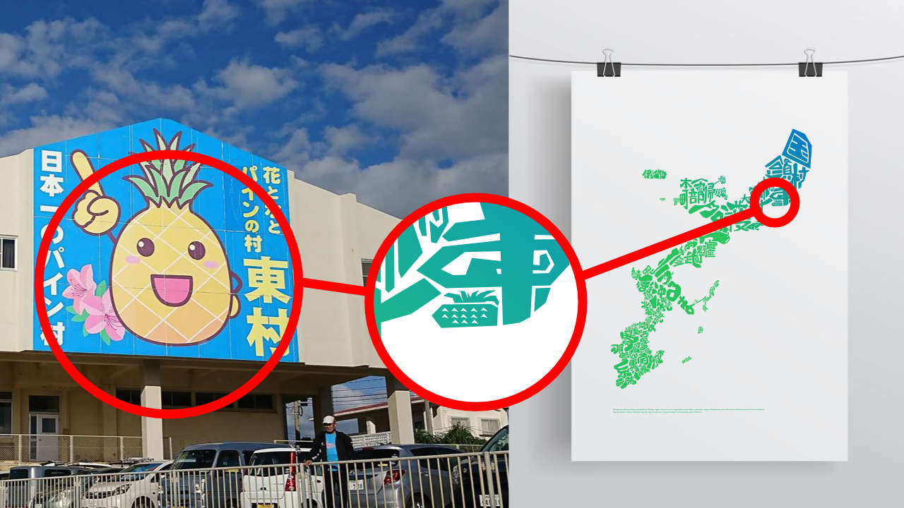
Secret In The Map #7: The Pineapple in Higashi Village Okinawa Japan
Did you see the pineapple hidden in your Okinawa map? Learn more about the story behind it and drive up north to experience it yourself.
-
Secret In The Map #6: Nago’s Dolphin Tail
Just off the north end for Okinawa Cross-State Highway, you will see a sea of blue on your left. The view here is so beautiful, especial on sunny days. It is…
-
Secret In The Map #5: Carrot Island
Find the small carrot hiding in your Okinawa Map and learn the story behind it. Follow the designer’s footprint to discover the slow lifestyle many come to seek…
-
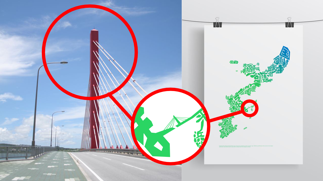
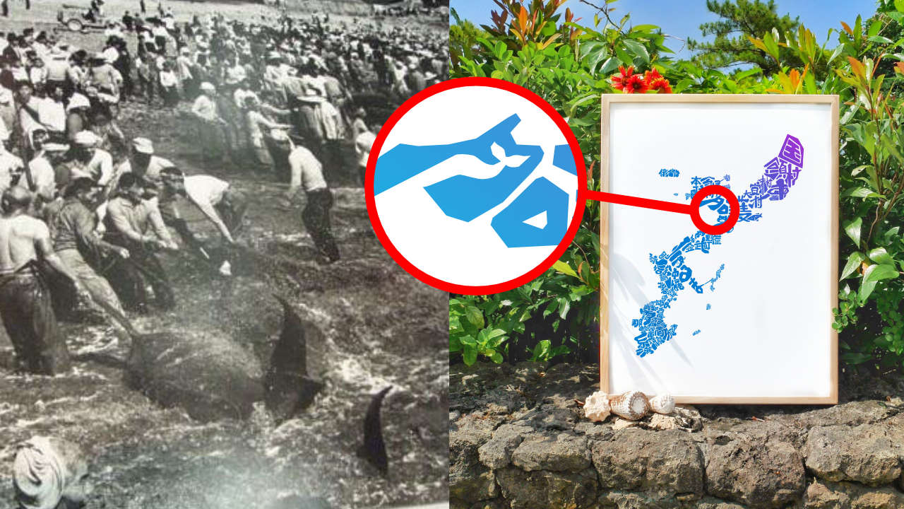
Secret in The Map #4: Kaichu Doro
From far away, it looks like a bridge stretch 5 kilometers across the ocean, connecting Okinawa main island and Henza island. It is a road build on top of the shallow seabed – Kaichu Doro. In Japanese, it means “the ro
-
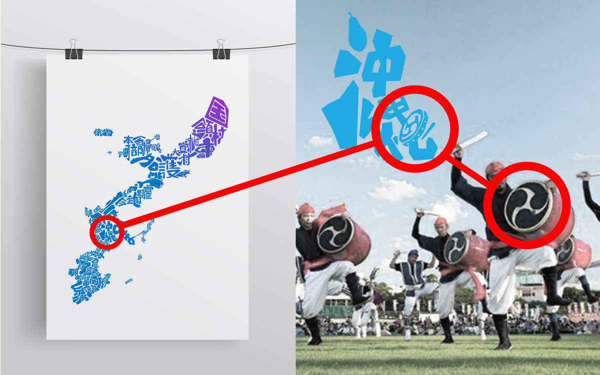
Secret In The Map #3: The Drum In Okinawa City
In this article, you will discover the secret hidden near Okinawa city on your Okinawa map. Come on in to learn more about one of Okinawa’s proudest tradition started 600 years ago…
-
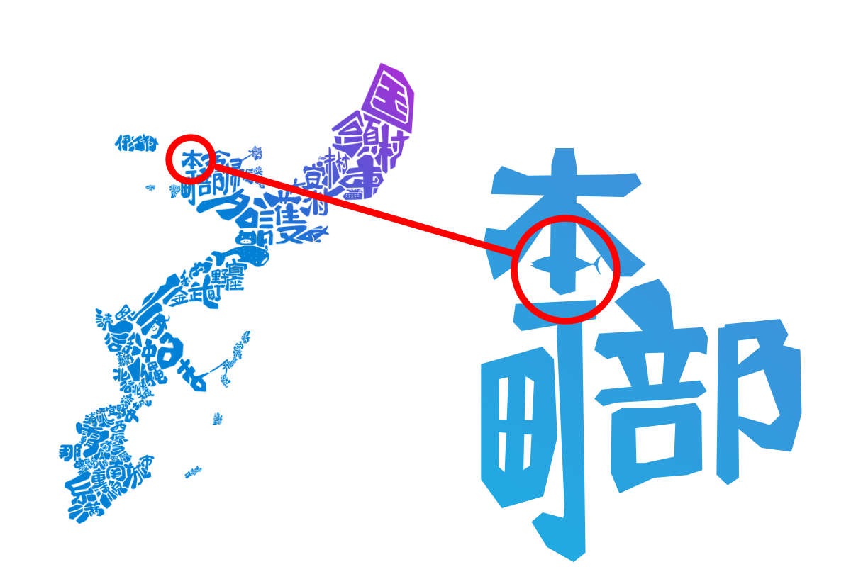
Secret In The Map #2: The Fish In Motobu
Did you see the fish near Motobu in the north part of your Okinawa map? You will learn the story about it in this post, and you will also…
-

The Okinawa Story Map: A Journey of Hidden Secrets
Meet the map that hides the secret of Okinawa. Explore the Japan’s subtropical paradise by learning its landscape, culture, and story on this iconic design.
-
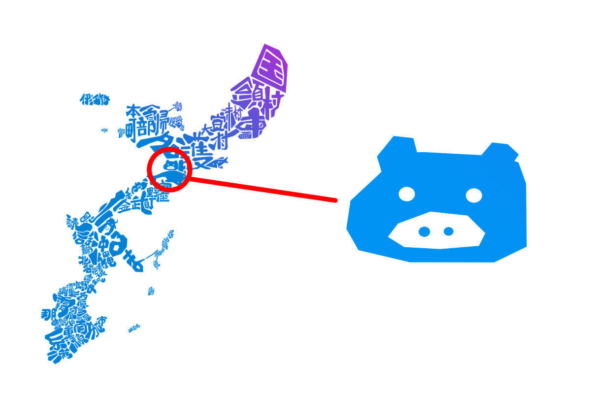
Secret in The Map #1: The Pig Face
We kick off the series of Secret In The Map with one the most noticeable symbols on the map – the pig face. You will learn what that stands for and the stories behind it…